Land Use Plan
ʔi ct scəw̓aθən təməxʷ
Our Tsawwassen Lands
Connecting People & Places across Tsawwassen Lands
The Land Use Plan reflected on this website sets out a shared vision for how Tsawwassen Lands will be cared for, used, and developed over the coming generations. Shaped by community voices, cultural values, and long-term planning, the plan provides detailed guidance across all land areas. We invite you to download the full 2025 Land Use Plan document to explore the vision, principles, and policies in their entirety.


EXPLORE MAP ABOVE OR CLICK ON TOPIC BELOW TO READ ABOUT LAND USE







Community Area
The Community Area is the heart of the Tsawwassen community, where Members can live, gather, and access everyday services close to home. It will continue to grow in a way that reflects Tsawwassen culture, supports Elders and families, and provides safe streets, community spaces, housing choices, and opportunities for Member-owned businesses. This area covers approx. 177 hectares of land and consists of three portions: the Village, the Tidal Marsh, and the Bluff.
Objective
The objective of the Community Area is to maintain community character and continue building the community near the water for Members to live, work and play. Protect cultural roots, ecological environment, and traditional activities such as hunting and medicinal plants.
Village
Policies
- Plan and develop a Cultural Centre.
- Plan and develop a Village Centre with facilities and services focused on Members.
- Plan and develop a civic plaza near the legislature to serve Members and leasehold residents.
- Plan a new cemetery to complement the existing one.
- Establish an assisted living facility for Elders.
- Support Member businesses by allowing compatible commercial and service uses.
- Provide controlled vehicle access at both ends of Tsawwassen Drive.
- Build and upgrade site services infrastructure to modern standards in collaboration with Members.
- Improve streetscaping and sidewalks on Tsawwassen Drive and Falcon Way to enhance safety, reflect cultural values and ensure functional design.
- Deliver moderate-density housing options with varied tenures and types for Members, including turnkey homes.
Tidal Marsh
The Tidal Marsh is an important natural and cultural area that must be carefully managed to protect wildlife habitats, medicinal plants, and sensitive ecosystems, while supporting flood protection efforts.
Policies
- Establish an ecological management zone to protect habitat and medicinal plants, and coordinate with the flood risk adaptation project.
sməq̓ʷaʔ xeł, the Great Blue Heron Way
Bluff
The Bluff must also be protected to preserve archaeological sites, maintain slope stability, and safeguard natural habitat, including the Pacific Great Blue Heron rookery.
Policies
- Establish an ecological management zone to protect archaeology site and materials, preserve natural habitat and stabilize the slope.
Canada’s Largest Heron Rookery


Neighbourhood
This is TFN's leasehold residential and commercial enterprise area, covering approximately 134 hectares of land.
Objective
Ensure quality development with well-integrated green spaces and compatibility with the adjacent TFN Community Area.
Policies
- Continue development in accordance with TFN’s Neighbourhood Plans, which will be updated as needed.
- Promote timely project delivery by TFSI developers through effective collaboration.
Mixed Use Area
The Mixed Use Area supports a range of commercial, entertainment, and service uses that serve both the Tsawwassen community and the wider region. It consists of the Tsawwassen Mills and the Tsawwassen Commons parcels, and the total land area is approximately 69 hectares.
Future development will create a walkable, transit-friendly area that reflects Tsawwassen culture and contributes to a complete, vibrant community.
Objective
Our goal is to support broader commercial, entertainment and services uses to meet local residents as well as regional needs, and to support appropriate additional market opportunities.
Policies
- Continue development of vacant sites.
- Allow for long-term residential development opportunities that advance TFN’s prosperity and align with market demands and the Mixed Use Area Development Strategy.
- Incorporate elements of Tsawwassen culture in new development.
- Contribute to a complete community by creating diverse uses, walkable and bike-friendly street networks, improvements to transit service, and vibrant new public spaces.

Industrial & Employment
The Industrial and Employment Lands are planned as a long-term logistics, distribution, and employment hub that supports economic stability for Tsawwassen First Nation. The industrial land designation is approximately 135 hectares. Development will balance economic opportunity with environmental protection, community well-being, and high standards for design and operations.
Objective
Ensure long term economic viability of the industrial lands by creating a national gateway logistics and distribution hub, balancing the pursuits of maximizing wealth generation, environmental stewardship, revenue stability and a positive social impact for the TFN Community.
Policies
- Use the vision, framework and processes outlined in the Industrial and Employment Lands Secondary Plan and the Industrial Land Strategy, as a foundation to ensure successful comprehensive development on these lands.
- Complete a review of future use opportunities and land use options for the water-facing area, with the aim of maintaining the integrity of industrial lands’ trade-enabling role.
- Periodically update land suitability and market analysis to ensure optimal land use mix around a core trade-enabling function.
- Update the Industrial and Commercial Design Guidelines as necessary.
- Establish an ecological management zone along the shoreline. Complete landscaping with culturally appropriate planting and maintain the buffer zone adjacent to the community with a high environmental standard.
- Large-scale commercial retail will not be permitted in this area, focus retail uses on those serving the daily needs of local industrial area employees.
- Avoid heavy industrial with significant environmental impacts on lands and waters.
- Establish community standards at the border between industrial lands and the community area to manage noise, dust and odours.
- Integrate alternative energy sources (e.g. solar panels or district energy) where viable.
Agricultural Area
The Agricultural Areas support food security, farming, and land-based economic activity for the Nation. These lands will be managed to protect agricultural use while exploring opportunities such as the community farm, managed forest, and future growth planning at Brunswick Point.
With the added Brunswick Point lands, the total area of the TFN agricultural designation increased to approximately 217 hectares.
Objective
To provide food security for the Nation and promote economically viable agricultural development.
Policies
- Continue development of vacant sites.
- Allow for long-term residential development opportunities that advance TFN’s prosperity and align with market demands and the Mixed Use Area Development Strategy.
- Incorporate elements of Tsawwassen culture in new development.
- Contribute to a complete community by creating diverse uses, walkable and bike-friendly street networks, improvements to transit service, and vibrant new public spaces.

Parks, Open Spaces & Blueways
Since adoption of the 2009 Land Use Plan, TFN has upgraded an existing park in the community area and added new parks on Tsawwassen Lands through ongoing land development. The Tidal Marsh and Bluff natural areas have been identified for conservation. Additionally, TFN continues to manage its blueways through maintenance plans for drainage courses that consider environmental impacts and approval requirements.
Objective
Create culturally meaningful, ecologically resilient, and socially connected spaces that strengthen community wellness, identity, and address climate change, while maintaining TFN’s stewardship commitments.
Policies
- Develop parks as safe, welcoming spaces for recreation, cultural expression, and community events.
- Ensure parks are accessible and integrated with neighbourhoods, schools, and community facilities.
- Design open spaces to protect ecology, support biodiversity, and allow for the exercise of Tsawwassen culture.
- Advance the Great Blue Heron Way as a cultural and ecological trail network.
- Integrate gathering spaces into neighbourhoods and corridors to support placemaking.
- Protect and restore blueways systems to improve the health of TFN’s shorelines, wetlands, and watercourses for future generations.
- Provide culturally and ecologically suitable access to foreshore and waterways for recreation, education, and cultural revitalization.
Water Lots
Through the Treaty TFN secured a 99-year lease agreement for two water lots totaling approximately 456 hectares (1,126 acres). Additionally, TFN holds Tsawwassen Fishing Right to harvest Fish and Aquatic Plants in the Tsawwassen Fishing Area and Intertidal Bivalves in the Tsawwassen Intertidal Bivalve Fishing Area under the Treaty. These areas are valued for their ecological functions, cultural uses, and recreational potential.
Transportation
Tsawwassen Lands are bisected by regional roads, Highway 17 and Deltaport Way. Major roads within the TFN jurisdiction including 52nd Street, Salish Sea Drive, Salish Sea Way, Tsawwassen Drive and 41B Street provide key connections to these regional roads.
Objective
Prioritize active transportation and enhance mobility and accessibility on Tsawwassen Lands, serving both local and regional economic needs.
Policies
- Develop a safe, accessible and integrated road network along with improved traffic control and signage.
- Collaborate with provincial and regional agencies to integrate with the broader transit system.
- Require new developments to dedicate land for road rights-of-way and trail connections.
- Monitor potential traffic impacts of continuing development, especially impacts on the regional network, including Highway 17, Deltaport Way and the 41B Street overpass with regional partners.

Infrastructure
TFN’s key infrastructure, including the TFN Sewage Treatment Plant, trunk sanitary sewers, stormwater trunk systems, pump stations, trunk watermains, waste and garbage collection, streetscape, and lighting – has largely been delivered through commercial and residential market developments, with financial support from TFN through the Offsite Levies (OSL) program. Upgrades to third-party utilities, such as telecommunications and hydroelectric services, have followed the trend of these developments.
The TFN Community Area has been served by sewer and water infrastructure since 2000, however, other infrastructure needs such as sidewalks, lighting, drainage, and vehicle access were not fully addressed at that time. Collaborative approach to infrastructure implementation on Member-owned lands, along with ongoing maintenance are key to ensuring infrastructure continues to evolve in response to changing community needs.
Objective
Build resilient, climate-responsive infrastructure that reflects Tsawwassen culture and supports a thriving, inclusive community.
Policies
- Improve physical infrastructure within the Village area to meet modern standards and expectations for roads, lighting, drainage, sewage, and water distribution.
- Deliver municipal infrastructure including roads, lighting, drainage, sewage, and water distribution through development.
- Maintain municipal infrastructure including roads, lighting, drainage, sewage, and water distribution through on-going maintenance planning and asset management.
- Improve stormwater conveyance and management design to support habitat, climate resilience, and cultural uses.
- Support infrastructure development through market projects and OSL.
- Collaborate with third-party utilities, including telecommunications, hydro, gas, and developers to ensure infrastructure delivery.
Sewage Treatment Plant
The TFN Sewage Treatment Plant is a critical piece of community infrastructure that supports current and future growth on Tsawwassen Lands. The $27 million facility was designed to protect surrounding lands and waters by treating wastewater to high environmental standards, while providing long-term capacity to support housing, community facilities, and economic development.

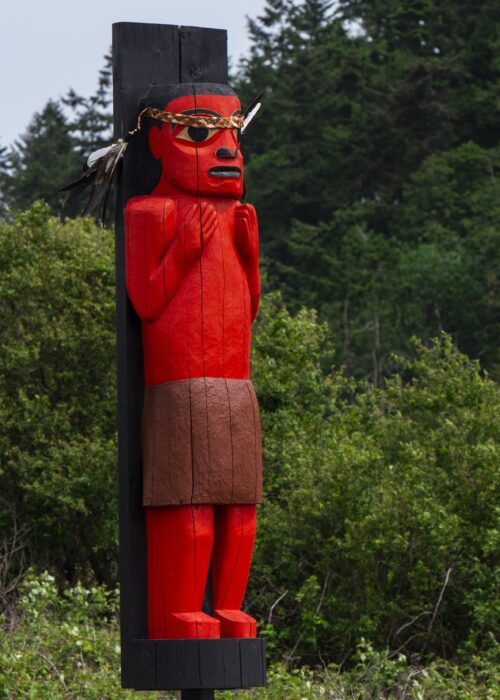
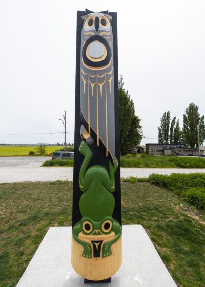
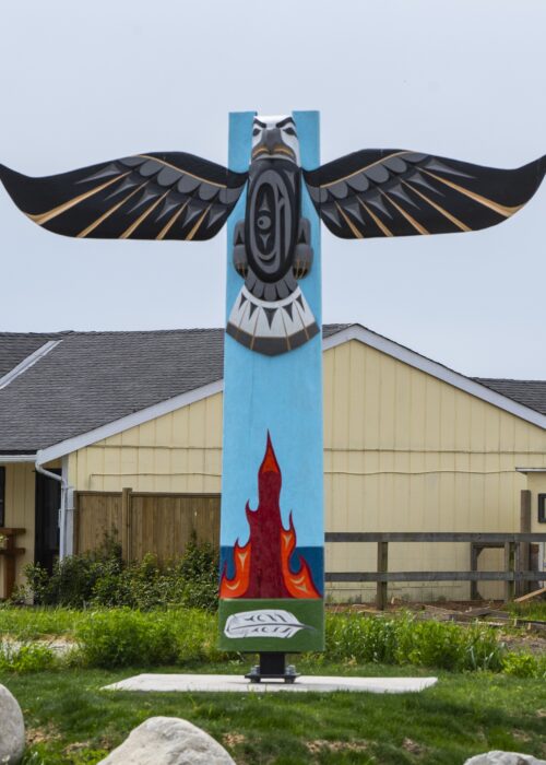
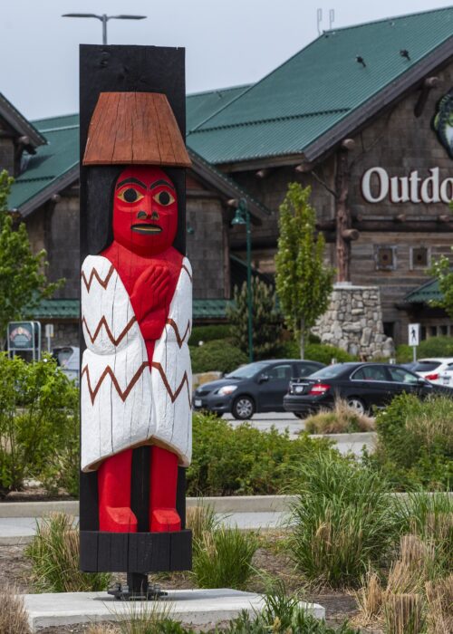
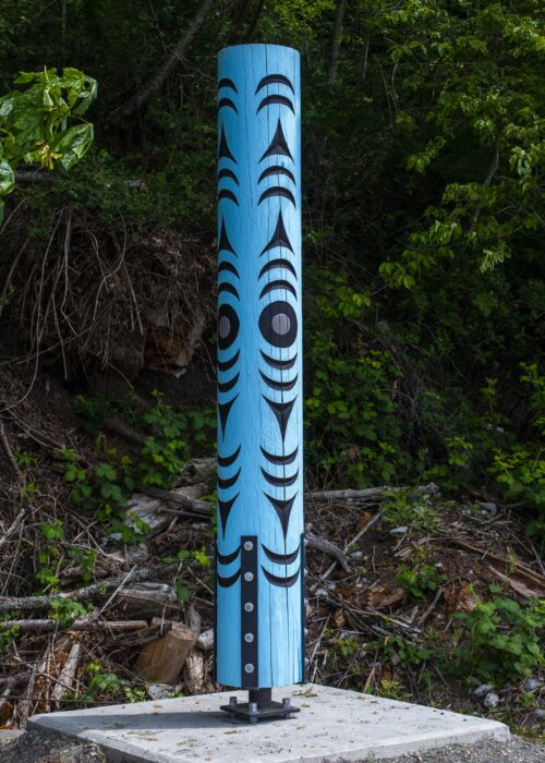
Boundary Marker House Posts
The boundary marker house posts are carved cultural markers that ensure the lands and people of Tsawwassen First Nation are protected. While beautiful to look at, they also have great cultural significance to TFN as a community and to the land.
Implementation
The implementation of the 2025 Land Use Plan will include updates to existing Secondary Plans, the Zoning Regulation and other relevant regulations to align with the new Land Use Plan. The Plan will also guide a list of initiatives, including Action Area projects, Study Area investigations and assessments, and development of new Secondary Plans.
Action Areas
The Action Areas (denoted with an Eagle Feather on the map) are where we need to take bold, timely decisions combining traditional teachings, best practices, and research.
Village Centre
To plan and to develop a village center that provides diverse Member-facing Services is a community priority. This is also an opportunity to preserve community character, develop a cultural identity and create a central hub for TFN members to live, work, and play.
Tsawwassen Beach Area
The Tsawwassen Beach vacant land area is identified for a future comprehensive development centered around a future Cultural Centre. During the engagement sessions, Members emphasized the importance of cultural knowledge sharing and creating community waterfront access.
Managed Forest
A Managed Forest will be developed within a portion of the community farm parcel, while retaining the agricultural land use designation. This pilot project will allow us to explore the creation of a space with more cedar trees, medicinal plants, hunting zones, wetlands, and green spaces.
The Sacred Cedar of Tsawwassen
For Tsawwassen People, cedar is one of our greatest gifts from the Creator. It is known as the “Tree of Life” because it provides for us in so many ways – spiritually, physically, and culturally. Every part of the cedar is used with gratitude and respect, and prayers are offered before harvesting.
Cedar reminds us to stand strong, to bend but not break, and to always give thanks. It teaches humility, protection, and the importance of reciprocity with the land. For Tsawwassen People, cedar is not only a resource – it is a relative.
Study Areas
This designation (denoted by a Heron Feather on the map) preserves flexibility for more details to be developed at the Secondary Plan level. These are where we need to exercise patience for these lands to develop in the right way as more information becomes available.
Industrial Waterfront Parcel
This parcel provides desirable access to the waterfront with opportunities for custom industrial uses, housing, and community uses. Further studies and consultation would help identify balanced land use options reflecting future development and protection, and Member needs.
13-Acre Parcel
Members shared ideas of a variety of community uses on this parcel including residential, Member facilities, business, and light industrial uses. Further studies and consultation will help identify uses to address Member needs and keep this former reserve land for Member use by including it in the TFN community area.
Port Adjacent Use Area
This agricultural land near the port and adjacent to the Brunswick Point lands is identified as Port Adjacent Use study area. During engagements, Members expressed interest in leading food security and other market uses, protecting farming and hunting activities, considering financial benefits and exploring growth opportunities of Brunswick Point lands. Conducting detailed study on the Port adjacent use area would help identify future use opportunities and development options.
Secondary Plans
TFN’s existing Secondary Plans include the following, they will be amended as needed:
- TFN Community Area Plan
- TFN Neighbourhood Plan Residential/Commercial Enterprise Area
- TFN South Neighbourhood Plan (fully built no longer applies as a regulatory document, referenced for historical information only)
The Land Use Plan identified new Secondary Plans include the following, they will be developed as more information is available:
- Mixed Use Area Plan
- Industrial and Employment Lands Secondary Plan
- Brunswick Point Lands Growth Plan
Approximate Boundaries
Boundaries of the land use designations on the website’s map – Our Tsawwassen Lands: Planning for Land Relationships and Land Use are approximate and are subject to minor adjustments. Any minor boundary change may be made without amendment to the Land Use Plan, provided it does not affect the general intent of the land relationships and land use planning.

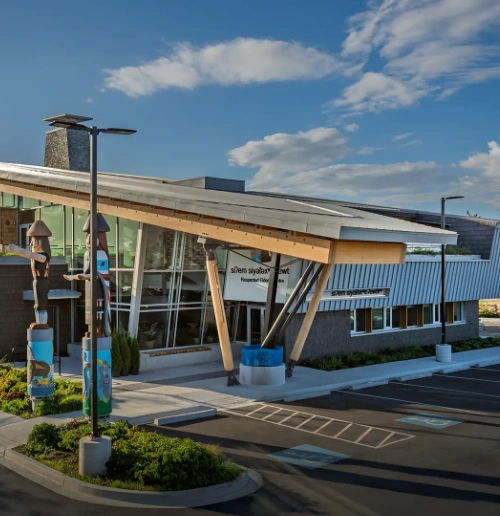
sməq̓ʷaʔ xeł, the Great Blue Heron Way

sməq̓ʷaʔ xeł, the Great Blue Heron Way (GBHW) is a visionary cultural and ecological trail project that connects TFN to neighbouring Nations and communities through a network of new and existing pathways. The vision for the GBHW has been inspired by the leadership of Tsawwassen First Nation Elder xʷasteniya (Ruth Adams). Its intended purposes are educational and functional, underpinned by a welcoming cultural expression from the Tsawwassen First Nation as a Host Nation. sməq̓ʷaʔ xeł embodies TFN’s commitment to intergenerational learning, reconciliation, and environmental stewardship.
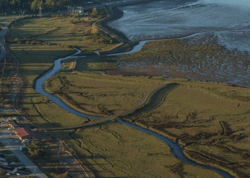
Canada’s Largest Heron Rookery
The Bluff is also a vital sanctuary for the Pacific Great Blue Heron. Around 400 nests and over 800 birds can be found here year-round. These ancient birds have been watching over TFN for generations.
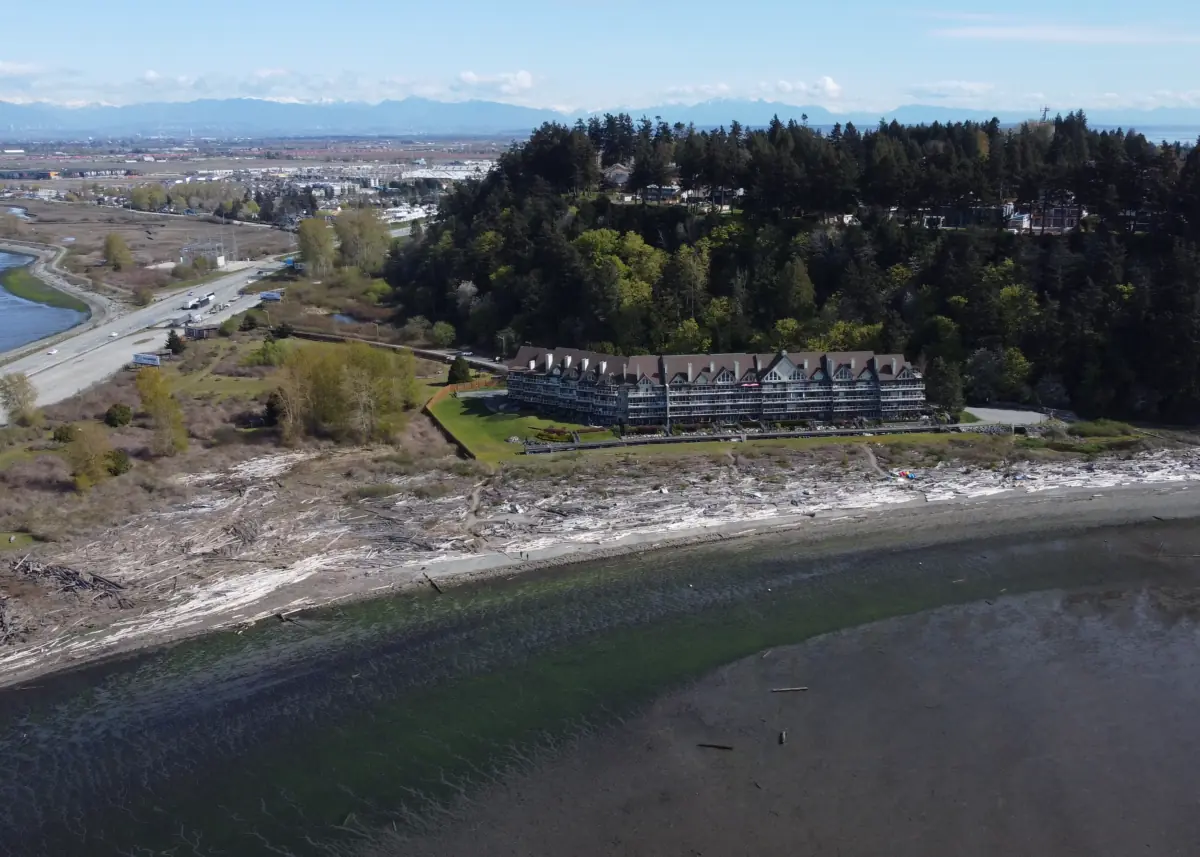
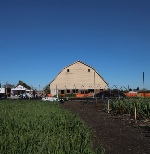
Community Farm
The Community Farm is a growing, land-based initiative that supports food security, learning, and connection to the land for Tsawwassen Members. It provides space for farming, community participation, and future opportunities such as traditional plants, managed forest areas, and intergenerational knowledge sharing.
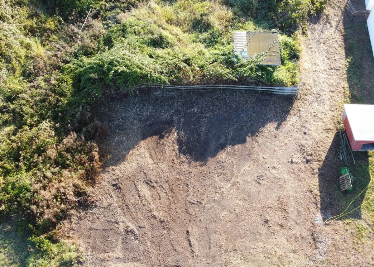
Goatscaping
TFN has completed several successful goatscaping projects as part of our plant species management plan, where the goats made quick work of invasive blackberry and Scotch broom. Goatscaping is a fun, eco-friendly way to tackle tough vegetation — no heavy equipment or chemicals needed! These hardworking and adorable goats quietly restore balance by eating invasive plants while keeping soils and surrounding habitats healthy. It’s a win for the environment and a pleasure for anyone watching them in action.
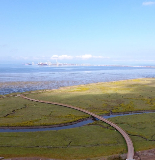
Port Adjacent Study Area
This agricultural land near to the port and adjacent to the Brunswick Point lands is identified as Port Adjacent Use study area. During engagements, Members expressed interest in leading food security and other market uses, protecting farming and hunting activities, considering financial benefits and exploring growth opportunities of Brunswick Point lands. Conducting detailed study on the Port adjacent area will help identify future use opportunities and development options.
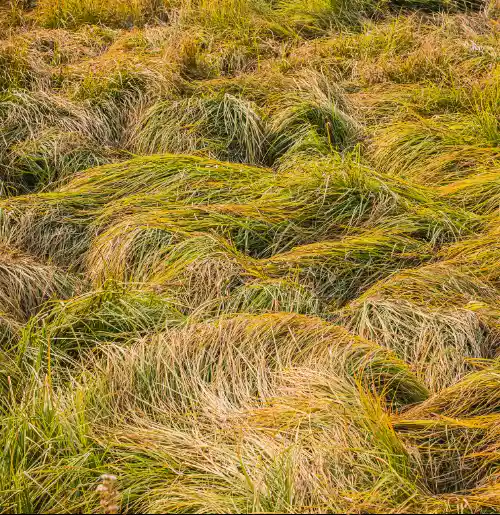
Potential Emergency Services
This agricultural land near to the port and adjacent to the Brunswick Point lands is identified as Port Adjacent Use study area. During engagements, Members expressed interest in leading food security and other market uses, protecting farming and hunting activities, considering financial benefits and exploring growth opportunities of Brunswick Point lands. Conducting detailed study on the Port adjacent area will help identify future use opportunities and development options.

Brunswick Point
Brunswick Point is a significant land area added to the Tsawwassen land base, totaling approximately 80 hectares, with 70 hectares now fully incorporated into Tsawwassen Lands. These lands are primarily designated for agricultural use and long-term planning.
House Post #1:
River Rd W – Canoe Pass in Ladner
The house post boundary marker located on River Road West at Canoe Pass in Ladner was carved by TFN artist Clifford Gurniak. This post depicts an owl and frog figure. The owl is a powerful symbol to TFN community and many are seen hunting on TFN territory at night. The frog is a representation of the land.
House Post #2:
28th Ave and 52 St
This post, located on the corner of 28th Ave and 52 St was carved by TFN artist Carl Morgan. It depicts an eagle with outspread wings and is a direct representation of TFN’s national flag.
House Post #3:
Tsawwassen Mills Mall
This post is located near Tsawwassen Milsl Mall at the corner of 52 St and Highway 17. It was carved by TFN artist Bryce Williams and depicts a female welcome figure representing a woman with her hands and arms raised up as in Coast Salish tradition to welcome visitors to TFN territory.
House Post #4:
Tsatsu Shores Beach
This post located on the beach is carved by TFN artist Bryce Williams and depicts Coast Salish shapes.
House Post #5:
Ferry Causeway
This house post depicts a Chief welcome figure with his hands and arms raised up. This house post was carved as an additional marker by TFN artist Bryce Williams to welcome visitors coming off the water.